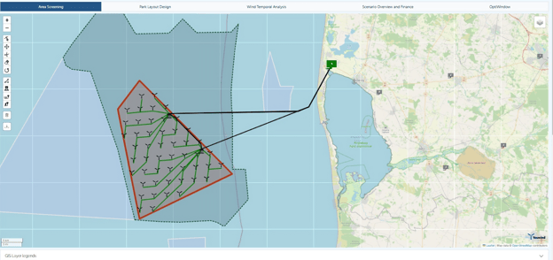
The Youwind Model is a powerful web-based application designed to optimise offshore wind projects by providing key financial and engineering insights. With its extensive library of customisable components and flexible data inputs, the model enables users to estimate critical indicators such as CAPEX, OPEX, and Levelised Cost of Energy (LCoE). By combining geospatial data with the Youwind Model, offshore wind developers can significantly improve project feasibility, reduce risks, and optimise performance throughout the project lifecycle.
The Importance of Geospatial Data in Offshore Wind Development
Offshore wind farms face complex environmental and logistical challenges that require precise data-driven decisions, and geospatial analysis plays a central role in overcoming these challenges. From site selection and cable routing to understanding environmental impacts, geospatial data provides critical insights into wind resources, oceanic conditions, seabed characteristics, and regulatory constraints.
For example, bathymetric data informs foundation design and installation, while wind resource mapping helps ensure that turbines are placed in locations where they can capture the most energy. Additionally, data on ocean currents and wave heights is crucial for optimising turbine performance and reducing potential damage to infrastructure. By integrating these data points into the Youwind Model, developers can align technical design decisions with real-world geographic and environmental factors.

ERA 5 Wave Height; Source: Youwind Platform
Leveraging Geospatial Data to Optimise LCoE and Financial Indicators
The Youwind Model offers the ability to integrate geospatial data layers such as wind speed, wave height, seabed conditions, and marine traffic into its components. This integration allows developers to perform sophisticated analyses that directly impact LCoE, CAPEX, and OPEX estimates, as well as other financial indicators.
1. Improving Site Selection and Feasibility
Geospatial data enhances the Youwind Model's engineering functions by allowing users to evaluate the feasibility of different sites based on spatial factors such as wind resource availability, depth of seabed, and proximity to shore. The ability to analyse these factors in conjunction with preset components (like turbines, foundations, and cables) ensures that users can identify the best sites not only for technical feasibility but also for minimising costs. This leads to lower CAPEX and more favorable LCoE values.
2. Customised Sensitivity Analyses for Site-Specific Conditions
The Youwind Model supports endless sensitivity analyses, allowing users to explore a range of scenarios and optimise both business and technical decisions. By integrating geospatial data, users can test how different site-specific conditions, such as varying wind speeds or seabed features, affect financial performance. For instance, the model can estimate how changes in wind resource density at a particular site would impact energy yield, and in turn, CAPEX and OPEX projections. This allows for more tailored decision-making and the ability to optimise wind farms for both performance and cost.
3. Bankable Energy Yield and Cable Loss Assessments
Accurate geospatial data inputs enable the Youwind Model to conduct bankable energy yield assessments by accounting for real-world variables such as wind speed and wave conditions. These assessments allow for the prediction of energy production over time, giving developers a realistic understanding of potential revenue. Furthermore, the model allows for precise calculations of array and export cable losses, based on geospatial factors like cable routing through marine environments. This reduces energy loss and optimises the placement of key infrastructure components, contributing to higher operational efficiency and better financial performance.
4. Enhanced Decision-Making for Turbine and Foundation Technologies
Geospatial data informs the selection of the most appropriate turbine and foundation technologies based on environmental factors. The Youwind Model enables users to simulate different technology choices and their associated costs under varying geospatial conditions. For example, developers can evaluate whether floating foundations are more viable in deep-water sites compared to traditional fixed-bottom foundations, factoring in the local seabed characteristics provided by geospatial mapping.

Water Depth Contour; Source: Youwind Platform
Conclusion
By combining the Youwind Model's powerful engineering and financial analysis tools with the insights provided by geospatial data, offshore wind developers can enhance their ability to deliver cost-effective and efficient projects. The integration of spatial data helps reduce uncertainties, optimise site selection, and improve both technical feasibility and financial outcomes, including CAPEX, OPEX, and LCoE. In a competitive and capital-intensive industry, leveraging the full potential of geospatial data through the Youwind Model enables developers to confidently de-risk their projects while maximising return on investment.


